THE 1983 ERUPTION OF MIYAKEJIMA
BULLETIN OF THE VOLCANOLOGICAL SOCIETY OF JAPAN
VOL. 29 SPECIAL ISSUE, 352p
with color photo pages (see below)
Text is in Japanese with English abstract and captions
1,500 yen
DECEMBER 1984
THE VOLCANOLOGICAL SOCIETY OF JAPAN
Photo gallery of the 1983 eruption
Miyakejima island (813 m a.s.l. and 8.5 km-across) is the upper half of a basalt stratovolcano, with calderas of the Hawaii type. Fourteen eruptions including the 1983 one had occurred since 1085.
Eruption started around 3 p.m. (JST), October 3, 1983. Fountains of basalt lavas appeared from the fissure vents in the southwestern flank of this island (500 m a.s.l). Lava flows descended separately, mainly, to the west and south. The western lava flow covered most of a village, where they tried to stop flowing of lava by spraying sea-water on the flow-front. The southern flow entered into the sea, generating strong phreatic eruptions, resulting in the formation of tuff ring. The eruption had declined by the early morning of the following day. The total volume of lava flows was estimated as 4.7x10^6 m^3 and that of pyroclastics was 6.0x10^6 m^3.
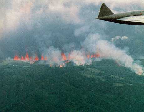
Photo 1
Lava fountains about 25 minutes after the start of the eruption. A-crater at the left-end with white smoke. B- to F-craters in a row form continuous curtain of fire. White smoke in the right is rising from lava flow issued from F-crater. The caldera rim runs from the left foreground toward the right center. Photo by Self Defense Force of Japan.
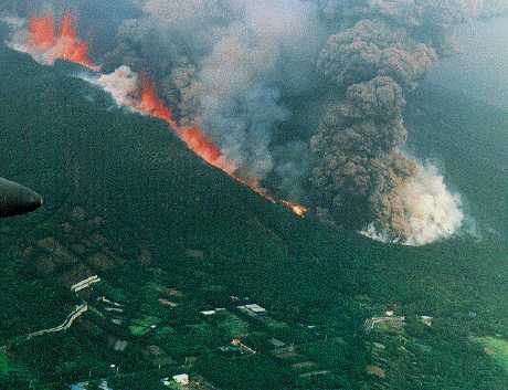
Photo 2
Crater rows extending to the south-southwest. About one hour after the start of eruption. K-crater at the right-end. A lava flow is spreading out of I- and J-craters on the left. Photo by Self Defense Force of Japan.
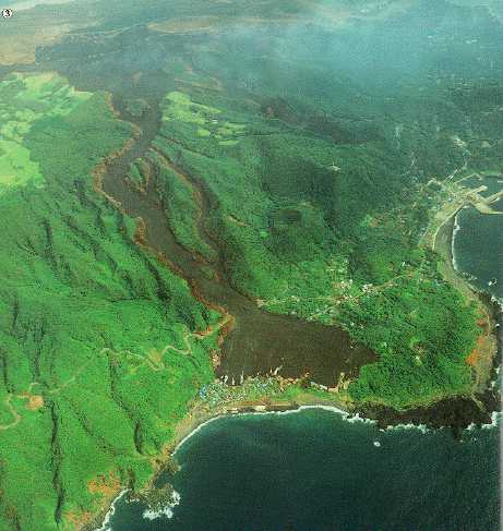
Photo 3
The western lava flow buried the Ako village (SW of island). White steam rising at flow front is produced by artificial water spray. A 4.5 km-long fissure in the background. Photo by Asahi Koyo Co., Ltd.
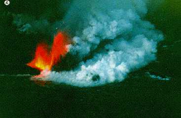
Photo 4
Activity at Nippana (S of island) around 17:40 hr (JST), October 3. Lava fountains at R-crater, and steam rising from S-crater. Photo by Maritime Safety Agency.
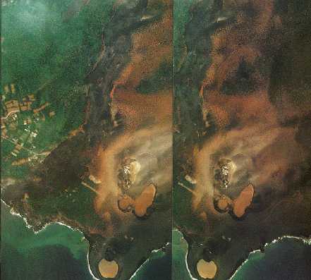
Photo 5
Stereo-aerial photograph showing the southern part of the fissure vents. Southernmost tuff ring at Nippana was lost by erosion 8 days after the eruption. Photo by Asahi Koyo Co., Ltd. (Only this photo is pasted from "Volcano landscape with Air-photo" (in Japanese), edited by VSJ and published from The Tokyo University Press)